
Verified airline flights · 27 U.S. regions
Golden-era aviation · live flight data
Every flight leaves a thread.
Choose a region, tap an airline flight, and see its verified route and reported positions in time order. Each entry shows when it arrived and where it came from.
Version 1 for iPhone · No account · No device location
Original Flight Thread aviation study · 2026
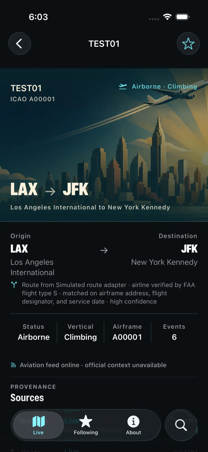
Actual app screen
Controlled route test · August 28, 2026
Tap a plane. Follow its thread.
The thread opens with the airline flight’s verified route, latest altitude, speed, track, and source. New observations join the log below. ATC and ACARS remain explicitly unavailable.
- Live map
- Route-verified airline flights across 27 named U.S. regions
- Flight thread
- One aircraft’s reported events, kept in time order
- Selection
- Private, military, general-aviation, and explicitly non-scheduled traffic is excluded
How it works
Map to thread
Choose a region. Open a flight.
The map shows commercial airline flights verified in the region you selected. Tap any one to see its route, current readout, and collected observations.
-
001
Choose a named region.
Select from 27 regions covering the contiguous United States, Alaska, Hawaii, and Puerto Rico.
-
002
Tap an airline flight.
Its detail screen shows the latest altitude, speed, track, and data source.
-
003
Read the updates.
Each event keeps its receipt time, source, and confidence so you can see exactly what was reported.
Not in version 1
No ATC. No ACARS. No guessed airlines.
TimeEvery position shows when it arrived. The timestamp comes from the source observation.
PrivacyNo account or device location. Your selected region and follows stay on your device.
MissingUnavailable means unavailable. The app does not substitute sample data.
Version 1
What the app includes.
Version 1 shows only route-verified flights that pass the app’s commercial-air-service policy, paired with current broadcast positions. It adds nearby NOAA weather and FAA airport advisories, and does not include ATC or ACARS.
Read the privacy policy- Included
- Route-verified commercial airline flights
- Included
- Nearby NOAA weather and FAA advisories
- Excluded
- Private, general aviation, military, and flights explicitly classified non-scheduled
- Not in v1
- ATC audio or transcripts
- Not in v1
- Published ACARS messages
Data sources
Where the data comes from.
Aircraft positions come from ADSB.lol community data under the Open Database License 1.0. Flight-plan routes and commercial classification come from FAA SFDPS plus a dated, reviewed carrier-designator policy. Weather observations come from NOAA’s Aviation Weather Center, and airport advisories come from FAA NAS Status.